Scooting down Taiwan’s east coast

This travel article was published in the Taipei Times on August 21, 2021. Read it below or on the Taipei Times website: https://www.taipeitimes.com/News/feat/archives/2021/08/21/2003762958.

The plan was simple: rent a scooter in Hualien, drive down Highway 11 to Taitung, and back up on Highway 9. This fairly comfortable two-day ride would take me through two of the nation’s more remote counties and along some of its most gorgeously scenic roads.

Of course, this trip can be made by tour bus, stopping at all brown-signed tourist hotspots along the east coast, while a car provides air-conditioned comfort. But riding a scooter offers a more direct connection to the land — the sound of crashing waves, the smell of the Pacific, the sumptuous views of mountains and sea — and its easy enough to pull off the road to check out that remote fishing village or unusual rock formation.

Despite the abundance of places to stop at, sights to see and attractions to visit, more than anything else I simply wanted to ride.

RIDING THE COAST

For those not in the know, Highway 11 hugs the east coast, sometimes only a matter of meters from the ocean, and Highway 9 lies a bit further inland, separated from the water by a ridge of densely vegetated hills.

Plan to arrive in Hualien early. Hiring a scooter takes a little time (details below), and the ride to Taitung will take five to six hours without stopping.

Almost as soon as you leave Hualien, you’re treated to wonderful coastal views with peaks and cliffs rising up steeply on your right and the Pacific Ocean stretching out to the horizon on your left. The experience only improves as you travel south and begin passing through the little, sun-drenched villages that flank the road. The houses here are so small and the pace of life seemingly so languid that it’s hard to believe this is part of the same country as Taipei, only a few hours up the road.

Come here when it’s overcast and you’ll find dark clouds hanging over these settlements and winds blowing up choppy, ominous waves on the ocean. When it’s bright, you’d swear that the sun will one day bake these villages out of all existence. Either way, you can’t help but feel awed by the overwhelming power of nature.

GORGEOUS TAITUNG

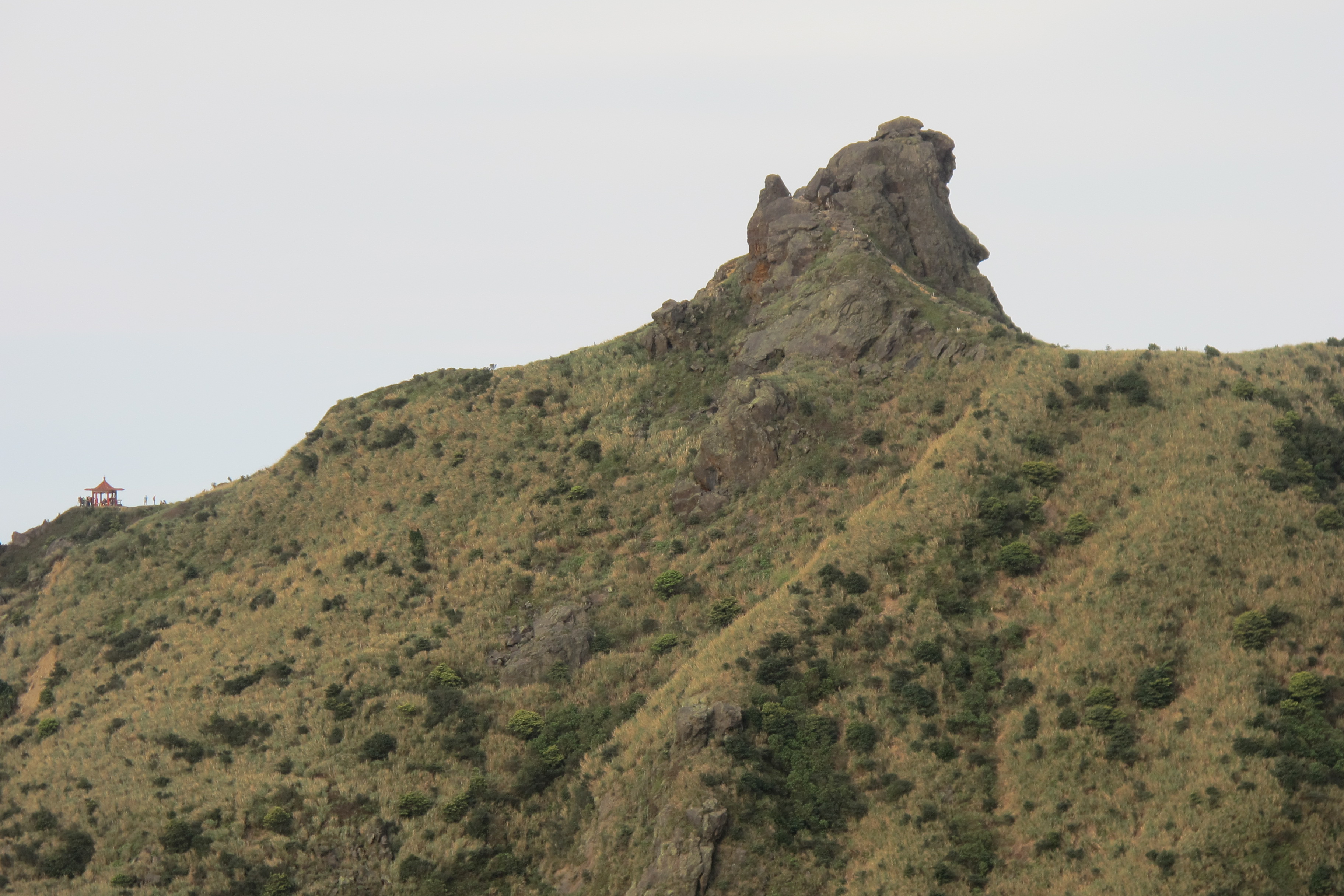
Moving into Taitung County, you’ll come across some lovely tourist destinations. The first, about 55km north of Taitung City, is Sansiantai (三仙台), a rocky island which legend says once attracted the Taoist immortals Li Tieguai (李鐵拐), Lu Dongbin (呂洞賓), and He Xiangu (何仙姑).

Visitors can follow a trail around the island and take in the weathered rock formations and coastal vegetation. The real highlight, though, is the scalloped bridge that connects the island to the mainland. It’s interesting by day but incredibly photogenic at both sunrise and sunset, so if you’re nearby in the late afternoon, stick around and enjoy the view.

Siaoyeliu (小野柳) is just a few kilometers north of Taitung, and like Yehliu (野柳) in the north — Siaoyeliu simply means “Small Yehliu” — it features remarkable geological formations. It’s apparently the result of thousands of years of erosion wearing down the differing layers of rock, and if you want more information, check out the on-site tourist service center. What you need to know is that you’ll see rock arches, mushroom rocks and potholes large and small. It’s weird and wonderful, and stopping for a photo or two really won’t add much time to your journey.

Taitung itself has been developed a lot in recent years, and there are now lots of hotels to stay in and restaurants to eat at. I spent the night at the Home Rest Hotel in the middle of the city — a clean and comfortable option, and at NT$1,451 including breakfast, it was good value for money.

The all-you-can-eat buffet at the Sheraton is fantastic, and on this trip, I ate at Wow’s Pangcha Cafe near the Railway Art Village. The village is a lively nightspot in the middle of the city and has art installations, a craft market, street food and (in non-pandemic times) live music at Tiehua Music Village (鐵花村). I chose Wow’s Pangcha because of its mouth-watering menu, and I wasn’t disappointed with my selection. Their pizza was among the best I’ve eaten for a long time, and I will be going back.

UP THE EAST RIFT VALLEY

As I left Taitung the following morning, I could see the towering Central Mountain Range that forms one side of the East Rift Valley, along which Highway 9 runs. It’s worth noting that this highway, like Highway 11, is generally wide and almost always well-maintained. Even in the pre-pandemic days when scores of tour buses made their way up and down these routes on a daily basis, riding a scooter here has never felt intimidating. Obviously, you still need to be careful, but, unlike on the Suhua Highway between Yilan and Hualien and pretty much any highway on the west coast, I’ve never felt stressed on these roads.

Back on the road, the fertile East Rift Valley offers views of verdant rice fields, banana trees and other vegetation. This is only separated from the blue sky by a dark green band of forested mountains and hills. The scenery is resplendent, and it just goes on and on for kilometers on end.

Ruisui Ranch (瑞穗牧場) and Chulu Ranch (初鹿牧場) are two places where you can rest and properly take in the surroundings. Even better is the Luye Highland (鹿野高台). Just 25km north of Taitung, the highland is famous for its large grassy meadow, and it’s currently hosting the Taiwan International Balloon Festival (balloontaiwan.taitung.gov.tw). The event runs until Sept. 12.

Ultimately, the east coast has plenty of famous attractions that visitors will go out of their way to visit, but to me, the real magic of the area doesn’t lie in these hotspots. Instead, I will always try and take in the land as a whole, riding along these highways and stopping wherever and whenever I please.

Posted in Travel writing, Uncategorized | Tagged , | Leave a comment

Hiking in Taipei is wonderful and weird

This editorial was published in the Taipei Times on May 16, 2021. Read it below or on the Taipei Times website: https://taipeitimes.com/News/editorials/archives/2021/05/16/2003757471.

“Hey, I’ve seen you before,” an elderly gent yelled. I was hiking past him on Bishanyan in Taipei’s Neihu District (內湖) and decided to stop and say hello. It turned out he thought I was someone else, someone almost a foot shorter than me and also not bald, but why get bogged down in details?

We had a nice, albeit strange, chat; he provided intimate details — details I neither asked for nor wanted to know — about how he did not feel his age.

Anyway, it was entertaining, and these surprising, random and overwhelmingly positive moments are regular experiences on Taipei’s hiking trails.

Whether it is solo hikers playing music out of loudspeakers for all the world to hear, middle-aged men yelling: “Hoooo” as loud as they can for no apparent reason, or just folks stopping you to overshare personal information, people — and the noise they make — are a big part of almost any hike you go on in the Taipei area.

This point has been made before in this newspaper, but where the writer of that other article found frustration, I generally only find pleasure (“A-holes on Taiwan’s mountains,” Sept. 3 last year, page 13).

I had reason to remember that article recently while I was out on a side trail leading off from the gorgeous Jinmianshan (Goldface Mountain). This peak, the main trailhead of which is near Xihu MRT Station, attracts large numbers of hikers, presumably most of them drawn by the picturesque rocky outcrops at the top of the walk.

Out on the side trails, things are a bit quieter, and I was walking in silence until my calm was pierced by the velvet tones of Michael Bolton. The song? When a Man Loves a Woman. It is a classic — of sorts.

Everyone knows it, but it is Michael Bolton, so it is rubbish. Hearing it out there on a muddy path, surrounded by trees in East Asia, was just plain weird.

When you consider the vast wealth of music that has been made over the course of human history, why would anyone ever choose to play the greatest hits of Michael Bolton while out on a weekend ramble? It defies logic.

Yet that is the thing about Taipei hiking: Much like a box of chocolates, you never know what you are going to get.

I have heard an old woman playing Latin-based hip-hop. I have passed a young guy puffing and panting his way up Elephant Mountain while also singing along to Elvis Presley.

By Xindian’s Yinhe Cave Temple, I heard Le Nozze di Figaro. You might not know the name, but it was the music Andy Dufresne played from the warden’s office at Shawshank Prison, and it was beautiful.

Clearly, not all the music you hear is beautiful, but it is always so incongruous with its surroundings and the people playing it that I do not know how it can fail to entertain.

The incongruity does not end with the music. On any given day in Taipei’s hills, you could see drunk people singing KTV, a young guy inexplicably going up the path backward on all fours, the oldest person you have ever seen or an old man with no shirt on using a hula hoop as if it were the most normal thing in the world.

Taipei’s hiking paths are varied, vibrant and picturesque, and the people you meet on them add color and surprise to any trek you take.

I do not know if it is always true that “people are the best scenery” — for one thing, there are simply too many truly beautiful landscapes to enjoy — but there is no doubt that people are the most interesting scenery.

Posted in Travel writing, Uncategorized | Tagged , , | Leave a comment

New TOEIC Test Preparation

In 2018, Bookman 書林 published my book of TOEIC practice tests.

Posted in Educational writing, Uncategorized | Leave a comment

R21 Book 4

My latest textbook was recently published by Caves. It’s a Content and Language Integrated Learning (CLIL)-based reading teaxtbooks, and it was designed to help young students develop their critical thing, collaboration, and communication skills.

IMAG1256

Posted in Educational writing | Leave a comment

R21 reading series

I wrote book 4 for this CLIL-based children’s reading series.

Posted in Educational writing | Leave a comment

Taipei Hikes

This article was published in en Voyage, EVA Air’s inflight magazine in 2016.

Taipei is a sprawling city of skyscrapers, busy roads, and high-rise apartment blocks, but it’s also a hiking paradise. The city is surrounded by hills and mountains that afford a wealth of hiking options that range from barren, exposed peaks to hills with dense, jungle-like vegetation.

During your stay in the city, you should get out and experience at least one of these trails.


Elephant Mountain

Elephant Mountain is one of a number of peaks that border Taipei’s Xinyi District. At 183 meters in height, it’s really more of a hill than a mountain, but from its top, you will be afforded fantastic views of the city.

img_2341

Several paths lead to the top, but the easiest to follow begins at the Elephant Mountain MRT Station about 600 meters from the trailhead. The route is well signposted, and moderately fit hikers should get to the top in about 30 minutes. Once there, the most popular place to stop is a small area with large rocky outcrops that people can clamber on and get great views of the city. The scenery is amazing during the day and possibly even better at night. If you are interested in a nocturnal walk, the route is always well lit.

img_2800

This is a popular hiking path, and the noise and activity means you’re unlikely to see many of Taiwan’s more unusual animals. However, squirrels, birds, dragonflies, and death’s head spiders are common sights.

img_1497

Elephant Mountain is one of the “Four Beasts,” a group of peaks that resemble the animals they’re named for – the others are Tiger Mountain, Leopard Mountain, and Lion Mountain. It is possible to walk over each of these hills, but the routes can be difficult to follow. A better alternative for those who want a longer hike is to follow the signs for 9-5 Peak. You’ll be taken up into the hills and high above the Taipei skyline. Depending on your level of fitness, expect a return walk of two to five hours.


Seven Star Mountain

At 1120 meters, Seven Star Mountain is Taipei’s tallest peak. Getting to the top is no easy feat, but your exertions will be worthwhile, as on a clear day, the views you get of the city are unparalleled. Even when the skies are overcast, this is an amazing walk that offers a wealth of geographical and geological features. The reason for this is that the mountain is actually a dormant volcano – the “seven stars” referenced in its name are the various peaks on the crater left by the mountain’s last eruption. In the surrounding Yangmingshan National Park area, you’ll also find hot springs and sulfurous fumaroles.

Getting to the hiking path’s trailhead requires a combination of buses and trains – or a much more expensive taxi ride. The easiest method is to take the MRT to Jiantan Station and from there, take either the 208 or Red 30 bus to their terminal stops. From there, follow the signs to the Visitor Center, where you can get maps and any extra information you might want. The route is well signposted, though, and even without a map, you’d struggle to get lost.

The walk from the Visitor Center to the Seven Star Mountain’s Main and East Peaks is only a few kilometers long, but it is steep and you’ll need to be reasonably fit to make it to the top. You should also come prepared for hot and sunny and also cold and rainy conditions. This is a fairly tall mountain, and unlike most of Taipei’s hiking routes, it’s very exposed and open to the elements. The weather can change quickly, and even if you leave central Taipei in warm sunshine, you might still encounter rain and fog on the mountain.


Maokong

Maokong is an entire area rather than a mountain or particular hiking trail. It’s famous for its plentiful tea plantations, but the truth is that apart from these patches of cultivated land – often terraced hillsides – the area generally resembles an expanse of barely tamed jungle. Despite these appearances, Maokong is fairly easy to visit, and hundreds of visitors make their way there every weekend on the Maokong Gondola – a cable car ride that starts near the Taipei Zoo MRT Station.

A number of trails wind their way around Maokong, and whether they take you through tea growing areas, camphor plantations, or dense undergrowth, they will give you an amazing sense of the area and the conditions that there were once normal in this part of the world before Taipei’s rapid development into one of the world’s most important cities.

In addition to going hiking, visitors to Maokong should also go to one of the area’s many restaurants to try the local tea and sample foods flavored with tea leaves. Another local attraction is Zhinan Temple, which can easily be reached via the Maokong Gondola. This huge Taoist temple dates back to 1882 and features a number of elaborate chapels and statues. A popular local belief about the temple states that unmarried couples who visit it together are destined to break up. Don’t say you weren’t warned!


Teapot Mountain

img_3826

Teapot Mountain is a fairly small and easily climbable hill at the eastern edges of New Taipei City. Its slopes are exposed and weather-beaten, its summit is crowned by an outcrop of rock that really does look like a teapot, and the views you get from the trail are amazing: narrow ridges and valleys spread out like fingers to the nearby ocean. Teapot Mountain is an incredible day trip.

img_3831

The easiest way to get there is by taking bus 1062 to the Gold Ecological Museum in Jinguashi. Once inside the museum’s grounds, follow the signs that lead toward the trailhead and head up the mountain. When you reach the top, you’ll discover that the “teapot” is actually a cave that you have to climb through to continue on your journey. On rainy days, the rocks can be slippery, but otherwise, the cave is surprisingly easy to navigate.

img_3797

Depending on your energy levels, you may want to go back down the hill and wander around the gold museum or continue along the path up to the taller mountain of Banpingshan. To reach the top of this peak, though, you will have to scale a 30-meter-high, near-vertical cliff. There are ropes to hold on to and holes in the rock for your feet, but it’s still a nerve-jangling ascent. The 360o views from the top, though, are well worth the effort.

img_3818

Posted in Travel writing | Leave a comment

TOEIC 3000

A couple of videos of me talking about my TOEIC vocabulary book.

Posted in Uncategorized | Leave a comment

TOEIC 3000

My latest textbook was recently published by Caves. It helps students develop their vocabularies and prepare for the TOEIC test.

img_4070

Posted in Uncategorized | Leave a comment

Excel

A four-level series of textbooks I wrote for Shane English Schools.

img_4071img_4072img_4073img_4155

Posted in Uncategorized | Leave a comment

Hike your way around the world

This article was published in en Voyage, EVA Air’s inflight magazine in 2016.

In an age when speed is the traveler’s watchword and when sights and destinations are collected rather than experienced, it’s good to slow things down and really take in the sights and sounds of the places you visit. There’s no better way to do that than grabbing a backpack and making your way along one the world’s great hiking trails.


The Inca Trail, Peru

Undoubtedly one of the world’s most famous hiking routes, the Inca Trail leads hikers 43km through the Andes before spectacularly terminating at the 15th century Incan city of Machu Pichu. The ancient settlement is the highlight of the walk, but the trail would be on many trekkers’ bucket lists even if the city had never been built.

The trail starts at an altitude of 2,800m, climbs to 4,200m at the infamous Dead Woman’s Pass and finishes at a height of 2,500m. Along the way, you’ll pass through forests and jungles and encounter towering mountains that, between June and October, are capped with snow. You’ll see scores of Incan ruins, tunnels and paving stones laid well over half a millennium ago.

It’s now impossible to hike the Inca Trail without a guide, and since permits for the route are limited, you should plan your adventure well in advance. Most tours last four days, which may sound like a long time for a 43km walk, but doing it this way means you can properly enjoy the scenery and avoid suffering with altitude sickness.


The Narrows, the US

The Narrows is the most spectacular of Zion National Park’s many hiking trails. Like so many of the other routes in this Utah hotspot, the Narrows winds its way along the base of a huge canyon with dizzyingly tall pink, cream and red sandstone cliffs. What makes this path so special is that while it’s around 600m deep, the walls are little more than 6m wide in some places. These dimensions leave hikers with a sense of the natural world’s awesome power.

Any hike through the Narrows will require that you get feet wet, as you will be walking along the bed of the Virgin River, but in the hot summer months, the cool water around your feet and shins can be refreshing.

Many people start their walk at the bottom of the canyon, heading upstream before turning round and heading back. However, if you get a permit, you can make your way downstream and cover the full 16km trail. While some hikers make the journey in a single day, others prefer to stretch it out over two, camping under the stars somewhere along the way.


The Coast to Coast Walk, the UK

Although not particularly old, this walk in northern England is iconic. It was originally devised in 1973 by celebrated Lake District hiker Alfred Wainwright, and it immediately became popular. The route is 309km long and goes through the Lake District, Yorkshire Dales and North York Moors National Parks.

Though hikers can start on either coast, the original, and still far more common, route is West to East. That means beginning at St Bees in Cumbria, where Wainwright advises walkers to dip their boots into the sea. From there, you make your way over several Lake District fells, along the area’s deep, beautiful valleys and through some of the world’s most picturesque villages. The rolling hills of the Dales provide slightly different landscapes, and walkers pass through the market town of Richmond before heading over Yorkshire’s vast, open moorlands. The walk, which is normally done over 1-2 weeks, ends at Robin Hood’s Bay, where you should, once again, dip your boots in the sea.


Hell’s Gate National Park, Kenya

At Hell’s Gate National Park, the idea of a walk on the wild side is taken one step further as you’ll be in an area with huge numbers of untamed animals. Africa’s big cats are not usually seen here, but over the last 50 years, lions, cheetahs and leopards have all been spotted. The park is home to giraffe, warthog, hyena, gazelle and buffalo, which are regarded as one of the continent’s most dangerous animals. Despite the dangers, you can walk here without a guide, and many trekkers say exploring the park on your own affords you a lot more freedom.

The park is around 90km from the capital city of Nairobi, so it’s fairly easy to reach, and it’s popular with hikers and cyclists. In addition to the wildlife, they come for the beautiful and varied scenery which is a mixture of grassland, rock towers and gorges with ridged, water-eroded cliffs. Hell’s Gate is also an area of geothermal activity, and it has a number of hot springs and geysers.


Overland Track, Australia

The Overland Track in Tasmania is a 65km trail that winds its way through some of Australia’s finest and most varied scenery. The trail, which most hikers take six days to complete, starts beside one of Tasmania’s top tourist destinations, the 1,500m tall Cradle Mountain. From there, it goes south through rainforest, alpine meadows, swamps and glacial valleys. The path also passes a number of dolomite mountains, which more enthusiastic and energetic trekkers climb as additional side-trips, before ending at the picturesque Lake St Clair.

Inexperienced hikers are advised to tackle the track in the summer, but since this is the popular time, you will have to book and pay for your trip. From June through September, hiking the trail is free but also more difficult due to poorer weather conditions and shorter days.


The Holy Ridge Trail, Taiwan

Possibly the most punishing of these hikes, the Holy Ridge is not suitable for inexperienced hikers. Even for those used to hiking in the high mountains, this is a tough path that includes steep climbs and a number of roped, near-vertical slopes. When you factor in the extra challenge of carrying all your equipment, this is one challenge that definitely shouldn’t be taken on lightly. The pay-off for those brave, fit and skilled to try is a unique ridge walk and unparalleled views of Taiwan’s incredible Central Mountain Range.

At a minimum, you’ll spend four days on the trail, though those in the know say five would be preferable. You’ll be above 3,000m on each of those days. Given the route’s difficulty, a permit isn’t easy to get hold of, and you will need a guide. If you want to take on the ridge, contact a local tour group. Taiwan Adventures www.taiwan-adventures.com is one of the best.

Posted in Travel writing | Leave a comment